Showers and storms overnight, then weekend
Showers and storms overnight
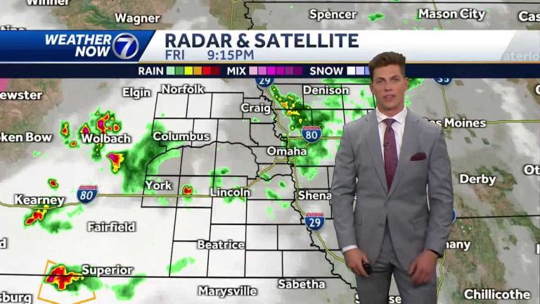
Application. Okay. The tournament kicks off tomorrow morning at Glenwood. Luke. Wet or dry? What I'm saying is dry. It's pretty much a coin toss, though. It's almost a coin toss. So there's a chance of showers early tomorrow morning and maybe even a few storms. But most of the action will last all night, so there's some good news for the weekend. It doesn't look like a complete shakeout by any means. Look at the three minute advantage that instant dual polling Super Doppler radar gives us. Uh, it's pretty dry for the most part right now, but there's some wet weather. Uh, about three different locations within the viewing area. First up are the north and east parts of the metro. If you're in the metro, uh, the metro is really uneven, mostly in Pottawattamie County on the Iowa side. Then as we look east to Seward and Utica, there's a chance we'll get stronger showers there and maybe a few lightning strikes there and then move further north and east. Seen over central and western Iowa where there are showers. But again, it's mostly just clouds and very gloomy as you get into the evening. This is a storm forecaster. The showers aren't quite as strong right now, but it gives us an indication that after 10:00 we're going to see more showers along and south of the I-80 corridor and maybe some storms. This is the prime area for overnight showers and storms. It will be located on the southern stretch of Interstate 80 into northwest Missouri. It's 5 o'clock tomorrow morning. It may also last into the morning. It looks like it will be in southwestern Iowa. That's going to be more of a target area. This is what it looks like outside. This is our CROWN POINT SKYCAM. The weather outside was pretty gloomy as we entered the night. 69 degrees. The dew point was 66 degrees, with a southeast wind around 10 mph. In Nebraska, Red Oak Plattsmouth is 73 degrees, Atlantic and Creston are 70 degrees, York is 68 degrees, and Norfolk and Tekama are 69 degrees. If you're going out tonight, you might be a little late. With temperatures dropping into the 60s, the weather will affect the chance of showers. Of course not everyone will see them, but if you're not, maybe the umbrella in Case 66 is where we hit bottom again, about a 50% chance. Overnight, the targeted area south of I-80 will mostly look like showers and storms. So we're going to use the storm forecaster again. The day begins in western Iowa and northwest Missouri after Saturday's showers and storms. But by the afternoon, the rain gradually cleared. By evening, the clouds may dissipate slightly. It's still 6:00, but opportunities are still sporadic. Rainfall will be light, but some of us may still see showers, or possibly storms. Saturday afternoon. So if you want to be on the safe side, just have a jacket ready. Or maybe it was the rain. Or excuse me, the umbrella on car 77 will be hot tomorrow. But for Saturday and Sunday, I want to point out again that you're going to see more sunshine than rain. We will likely reach highs near 80 degrees on Monday the 80th. There will still be icons of influence on Tuesday. We have upgraded this day to an impact day with a chance of showers and possibly even storms. This is a system. Temperatures will be cooler in the upper levels from Saturday to Tuesday. Now the Midwest is on lockdown. That's why there are so few opportunities during this time. But by the time we get to the middle of next week, things will be much better. By this time next week, there will be more sunshine and temperatures will be back to seasonal averages. Get FE
Showers and storms overnight, then weekend
Showers and storms overnight
Showers and storms are possible overnight and some of us may see some activity continuing into tomorrow morning. Meteorologist Luke Vickery helps you plan for the weekend in his Weather Today forecast.
Showers and storms are possible overnight and some of us may see some activity continuing into tomorrow morning. Meteorologist Luke Vickery helps you plan for the weekend in his Weather Today forecast.

