Current radar:
Showers and storms are likely on and off this week. Check out our current radar below.
Wednesday weather forecast:
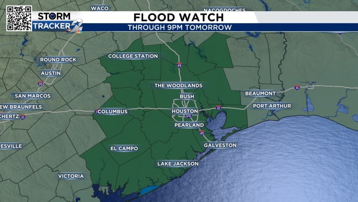
There were no changes Wednesday. Heavy rainfall will occur across Southeast Texas. Abundant tropical moisture brings us another flood threat. The highest totals so far appear to be south of I-10.
Thursday's forecast:
Stalled front lines posing a threat of flooding remained in place Thursday. The Weather Prediction Center has raised the flood threat to Level 2 out of 4.
The stalled front mixes with tropical moisture, bringing bursts of rain and thunderstorms. Generally speaking, we'll get another 3 inches to 5 inches of rain over the next five days. Street flooding is possible in the morning or afternoon.
Track the tropics:
There is no tropical activity in the Gulf, Caribbean or Atlantic Ocean. Saharan dust is very heavy across much of the tropical Atlantic, making things very quiet.
10-day forecast:
We've been in this active storm pattern all week. Pay attention to weather conditions and make sure you allow extra driving time. Increased rainfall means cooler than normal temperatures. 95° is our average for this time of year.
Copyright 2024 KPRC Click2Houston – All rights reserved.
