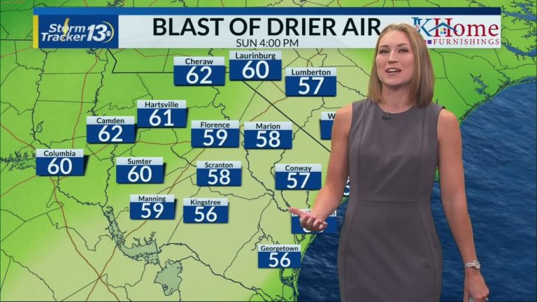
MYRTLE BEACH, S.C. (WBTW) – Today will be the last day of several days of heavy rain in the area. A trough will move southward and carry stormwater away. There will be a big change on Sunday with a cold front moving in from the north on Saturday night.
Today's storms may bring high rainfall amounts, which may cause localized flooding. The Weather Prediction Center predicts a slight risk (15%) of excessive rainfall for all of our regions. A flood watch is in effect until 7 p.m. Rainfall totals of more than 1 inch are possible but will occur in isolated areas. Not everyone will see rain today and coverage may be less than yesterday.
Drought conditions improved mainly in border areas. The latest rainfall totals observed by drought monitors show that during the week-long period (July 16-22) in Florence, Laurinburg, Myrtle Beach and Hartsville, some monitors received more than 4 inches. With heavy rain falling across the region, drought conditions are expected to improve further with the release of a new Drought Monitor next week.
Showers will continue tonight into Saturday morning, with a few storms possible Saturday afternoon. The front will move offshore and eastward Saturday night. This will allow dry air to move in Sunday and Monday and we'll have a few rain-free days with cleaner air. Dew points will drop into the upper 50s and lower 60s; levels not seen since early July 2nd. It’s rare to get away from the humidity at this time of year, so enjoy it!
Moisture will return on Tuesday, with a chance of thunderstorms mid next week.
