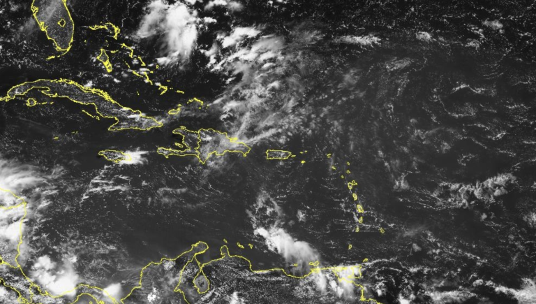
This year is forecast to be an extremely active hurricane season, which started strongly with the formation of Hurricane Beryl on June 29. However, no tropical cyclones formed in the first half of July. The explanation for this is due to the behavior of several phenomena, the three most important of which we can mention are the Saharan Dust, the Madden-Julian Oscillation and the Southern Oscillation.
First, large amounts of dust from the Sahara Desert are reaching an area known as the “Main Atlantic Cyclone Development Zone,” which includes the area between 10 and 20 degrees north latitude. The area is characterized by high temperatures and dominant flow of trade winds. However, with the intrusion of dust carried by these winds, humidity decreases, resulting in less cloud formation, which affects the formation of cyclonic systems.


Saharan dust clouds cover the entire Atlantic major cyclone development zone, including the area between 10° and 20° north latitude.
Notably, although Saharan dust prevents solar radiation from further warming the ocean, the heat stored in the ocean since May has not yet been released, and forecasts for a very active season remain. This flow peaks above the normal average during the first 15 days of July and will begin to decrease towards the end of July, and the formation of cyclonic systems will begin to increase. It’s worth mentioning that dust plays an important role in Sargassum blooms, as it acts as a fertilizer for these algae.
Another very important factor that has occurred since early July is the intensification of the Madden-Julian Oscillation, which is a low-pressure wave or area of low pressure that moves across the globe over a 30 to 60 day period. The wave comes from the western Pacific and occurs during a neutral or weak La Niña phase, which affects both the ocean and the atmosphere, affecting precipitation patterns.
The Madden-Julian Oscillation may contribute to widespread and sustained suppression of tropical cyclone formation throughout the Western Hemisphere, particularly over the next few weeks, thereby reducing the chance of continued Atlantic tropical cyclone development. But according to forecasts, the effects of this phenomenon should subside by early August. Madden-Julian oscillation index forecasts are derived from hurricane models, including the US GFS and the European ECMWF. Both agreed that the oscillations in late July and early August would weaken.
Another phenomenon is ENSO, an ocean concept made up of two parts: El Niño (EN) and the Southern Oscillation (SO). ENSO occurs in the Pacific Ocean and consists of three phases: a cold phase called La Niña, a warm phase called El Niño, and an intermediate or neutral phase.
From August to October, La Niña conditions are expected to become active; ENSO neutrality is expected to continue in July, according to NOAA reports. There is a 70% chance of La Niña conditions arriving between August and October and is expected to persist during the Northern Hemisphere winter of 2024-25 (79% chance of developing between November and January).
Given this situation, a favorable environment is expected for the development of storms and hurricanes across the Atlantic, so forecasts for a very active season remain and are likely to intensify during August to September. Therefore, the public is advised to stay informed of the situation through official media and continue to be prepared to mitigate the impact of any climate phenomena that occur.
