tonight: Showers and storms will cause more flooding issues tonight before everything tapers off overnight. A few showers and maybe some rumble of thunder are possible early Monday morning, but most of us will be dry. Lows will be in the mid to lower 70s and the air will be very muggy.

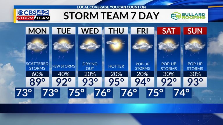
on Monday: Many of us will start the day with cloudy skies with scattered showers in the northern half of the region, followed by more scattered showers and storms in the afternoon. They won't be as widespread as they will be this weekend, so high temperatures will be a little warmer. Highs are expected to be in the mid-80s, with a few spots remaining dry, and temperatures could reach 90° or higher as there should be a few sunny spells.

Looking to the future: A ridge of high pressure will continue to be centered to our south and west into Tuesday, so there's still a chance of rain Tuesday afternoon. This allows rain chances to begin to decrease Sunday night into Tuesday, then fall back to around 20% Wednesday into Friday.


Later this week, the ridge will begin to extend into the Deep South, enough for our temperatures to respond and warm back up to above average. Starting Wednesday, afternoon temperatures are forecast to return to the mid-90s, with the warmest days being Thursday and Friday. With very high humidity this week, this will allow heat index values to climb above 100° later in the week.
