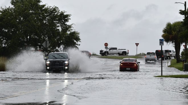
Another round of severe weather swept through the Southeast on Tuesday, causing power outages and airport delays after a deadly storm hit the region the day before.
Central and northern Florida and the Ohio and Tennessee valleys are expected to see the strongest storms, including damaging winds, tornadoes and up to 5 inches of rain, with the potential for large hail in these areas. Areas from Mississippi to Indiana and parts of North Carolina are also at risk for severe thunderstorms, according to the National Weather Service Storm Prediction Center.
In Georgia, high winds toppled power poles and blew trees onto major roads throughout the morning and early afternoon, causing traffic jams and headaches for commuters. Delays are increasing in Florida. The Federal Aviation Administration issued a temporary ground stop order for Orlando International Airport at 11:30 a.m., with major airports in Tampa and Miami reporting departure delays of more than an hour, according to the FAA.
About 12,000 people were without power in eastern and southern Louisiana as of 5:30 p.m. ET on Tuesday, as several rounds of storms swept through the area, threatening tornadoes, according to the USA TODAY outage tracker. More than 16,000 power outages were reported across Florida, with the majority in Leon County, home to the state capital of Tallahassee, which was hit by three tornadoes on Friday that local officials said caused “Historic” destruction.
Parts of Northeast Florida received nearly 8 inches of rain from Monday morning to Tuesday afternoon, according to the weather service. The worst of the storm is expected to move off the Atlantic Coast Tuesday afternoon, although intermittent showers and thunderstorms are possible overnight in northern Florida.

Storm kills 2 in Louisiana
A woman was killed Monday night when a tree fell on a mobile home in West Baton Rouge Parish, east of downtown Baton Rouge, Louisiana, local media reported. Officials in St. Martin Parish also reported one death related to the storm but provided no additional information.
St. Martin Parish Sheriff Becket Breaux said in a Facebook video that depending on the severity of the damage, a tornado may have hit the area. Broux and Henderson Mayor Sherbin Collette urged residents to stay off the roads and to monitor the latest weather conditions.
“We have a lot of road damage; water across the road, trees across the road, debris everywhere,” Collette said. “The damage right now is really significant.”

This week's forecast: Storm threat for much of central and eastern U.S.
The weather service said showers and storms are expected to spread eastward across the mid-Atlantic and Northeast on Tuesday in the valleys of Missouri, Mississippi and Ohio.
The storms flooded streets and swollen rivers in parts of the central United States, particularly in Missouri, where two tornadoes threatened to form on Monday.
While the Northeast faced rounds of showers that could cause localized flooding, the Mississippi Valley got a brief respite from the severe weather. However, the next round of showers and storms will begin to move into the area starting Wednesday night.

Record heat hits South Florida
Dangerously high temperatures are expected to spread to South Florida this week as humidity pushes heat indexes into triple digits.
Wednesday is expected to be the hottest day: a daytime high of 95 degrees. The National Weather Service in Miami said Wednesday's heat risk level is at the “severe” level, meaning the heat index, or “feel like” temperature, could soar to 108-112.
The normal high temperature in mid-May is 85°C to 86°C; the normal overnight low is 71°C.
Following several record-breaking high temperatures last week, this week has brought another high temperature, with temperatures reaching as high as 97 degrees on Saturday. That beat the 95-degree high temperature set in 2011.
Large hail and strong winds in southeast
While the weather service has not confirmed whether a tornado occurred in St. Martin Parish, a tornado was reported in Calcasieu, about 100 miles west of St. Martin. Meteorologists recorded hail the size of nickels and golf balls in northern Florida and eastern Texas on Monday.
At least two people were injured after several campers and RVs overturned during the storm in Calhoun, Texas, on the Gulf Coast about 80 miles north of Corpus Christi, the weather service reported.
Downpours caused waterways to rise several feet from East Texas to the Florence Panhandle, and dozens of authorities reported flooded streets and water damage affecting homes and businesses. Streams and rivers were already near or at flood stage before Monday's storms unleashed rounds of downpours, and much of the ground was soaked due to strong storms in recent weeks.
Contributor: Kimberly Miller, The Palm Beach Post; Jim Little, Pensacola News-Journal; Jorge L. Ortiz, USA Today
