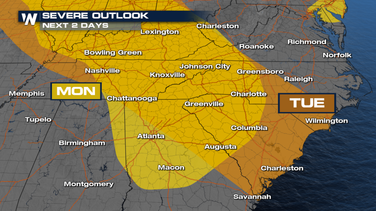
The Southeast is no stranger to storms and showers this time of year, but thanks to An active pattern in the country’s northern region, we now have a chance to see some stronger storms across the Southeast on Monday and Tuesday. The main concern was having to deal with strong, damaging wind gusts from some units that popped up in the latter half of the day. Storms will become isolated in the early afternoon and then become more scattered as we head into dinner time.
Serious threat continues until Tuesday marginal risk (Category 1 of 5) extending to the South Carolina coastline. The main threat will remain the same – strong gusty winds possible. What's different about this forecast is the timing of the storm. Some storms may continue Monday night into Tuesday morning. This means severe storms could pose a threat at any time of day.
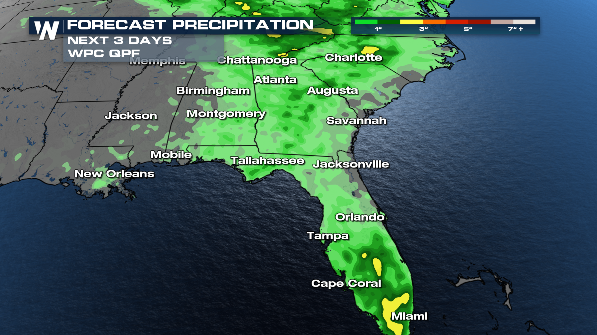
All of these storm possibilities leave many locations with the potential for more than 1-3 inches of rain over the next three days. All weather warnings in your area and do not drive through flooded water.

