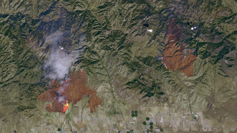
As the climate warms, extreme wildfires are becoming more common.
But scientists are now using data collected by NASA's Earth-observing satellites to help keep people safe.
Hawkins: “Earth observations are extremely valuable for detecting, observing and managing wildfires.”
Michelle Hawkins works with NASA on climate resilience.
Satellites can pinpoint locations with large amounts of flammable material, such as dry vegetation, before fires break out.
Land managers can then use this data to plan prescribed burns to reduce the risk of out-of-control fires.
When wildfires do occur, satellites can also help officials understand how large the fire is and how it is spreading so agencies can provide immediate safety alerts.
Hawkins: “For example, we have imagery, data and information that can show the extent of a fire so emergency managers can provide updates on evacuation orders.”
After wildfires end, satellites can spot places with higher risk of landslides, which could occur in recently burned areas.
So even as the planet warms and the risk of wildfires increases, these eyes in the sky can provide the data officials need to keep people out of harm's way.
Reporting credit: Ethan Friedman/ChavoBart Digital Media
We help millions of people understand climate change and what to do about it. Help us reach more people like you.
