Yes, it's a conspiracy. Fat cat surface weather machine
- High in the North Pacific and its northwest winds
- North wind in four corners
- Low pressure south of Cabo
They all follow the commands of their climate overlords, the jets and their upper troughs migrate northwardly and drive winds along the ridges of surface wind energy.
The reasons behind this annual migration are beyond the scope of the blog, but let's take a look at some images of these wind-energy machines and how they increasingly deprive Cortez of the north wind in late spring.
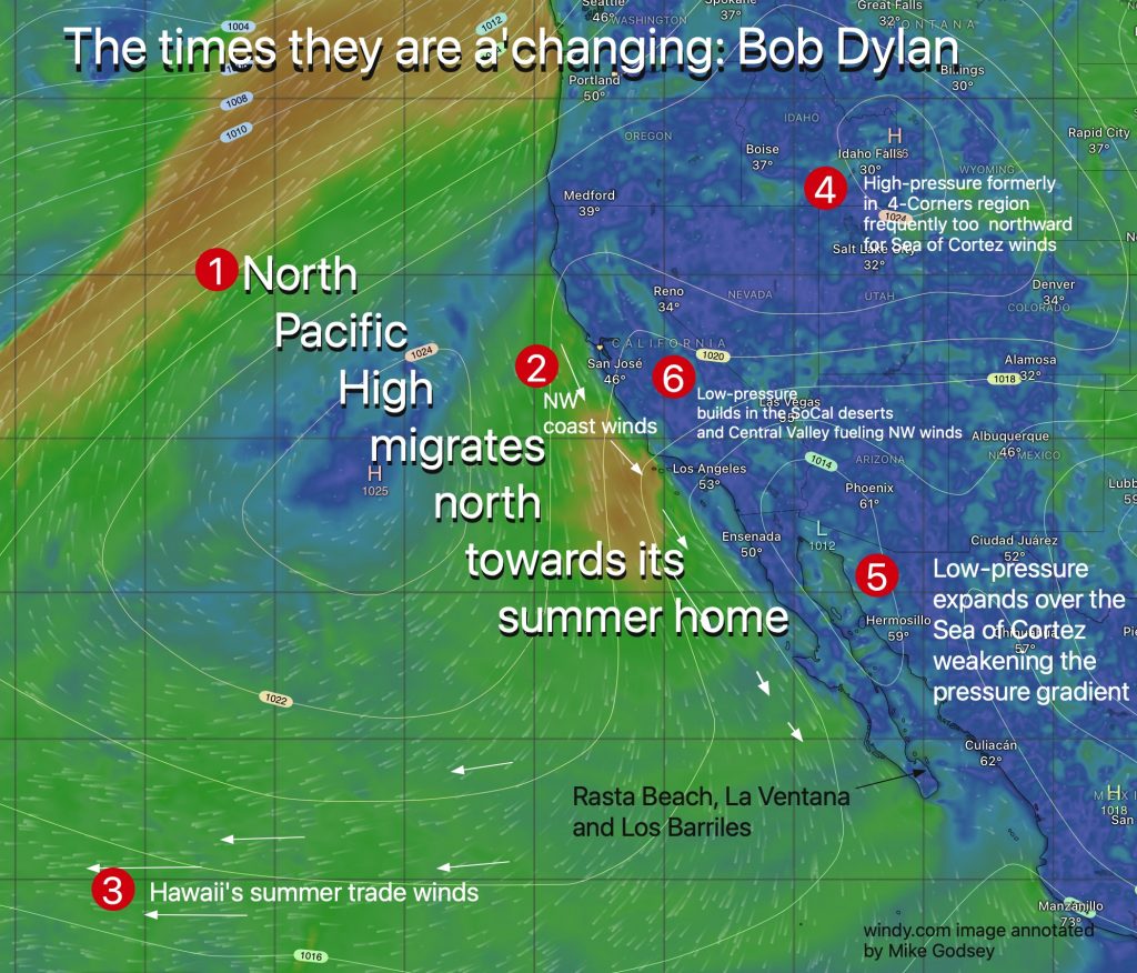
- As we enter April, a large number of high pressures in the North Pacific began a slow marching north. In winter, its average position is near Baja, and its pressure gradient is represented by the white iSobar line, usually stacked on the Cortez ocean in the NNW winds of the Baja and Cortez seas.
- Note how the average position of NPH is near Southern California in late spring. This brings northwest winds to Southern and Northern California, with mild winds to Bajasul and no wind to the Sea of Cortez.
- This NPH location also brought a stronger oriental trade trend to Hawaii. So in April, it is planned to fly the Gulfstream from Cabo to Maui. Huge headwinds will reduce fuel costs.
- Meanwhile, the best Baja wind energy machines, high pressures are getting farther and farther away, and cannot cause north winds in the Cortez sea.