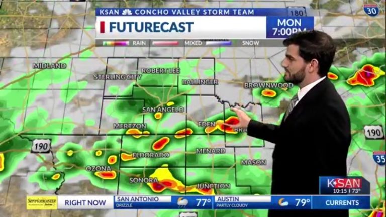
After another stormy day in the Concho Valley, most of us had temperatures rising into the 80s or 90s, but were quickly cooled down to the 70s by the rain-cooled air. Most areas in the central and southern counties and cities experienced better soaking today, while the northern counties experienced less soaking than yesterday. In San Angelo we are reporting about 0.1 inches by dinner time, but we will collect more tonight which should increase our total.
Tonight, we will see a lot of clouds and scattered shower activity across the area. Especially near the I-10 corridor, models are hoping for the heaviest rain to continue into tomorrow. Lows in some areas should tend to be closer to the 70s and possibly even into the 60s. Winds will be light over much of the Southeast, around 5-10 mph, but will be gusty with some storms before midnight.
Tomorrow is going to be a wet day for San Angelo and much of the area! Similar to today, it should start to light up more on the radar as we move into the afternoon hours. Temperatures are looking much milder than today, stopping before we reach the 90s and settling into the mid-80s for daytime highs. Winds will also shift to the northeast with gusts around 5-10 mph, but may become stronger as thunderstorms pass through.
Longer term, we're stuck in this mildly rainy pattern throughout the 7-day weather forecast. From Monday to Wednesday, the odds dropped sharply from 70% to 50% to 30% respectively. Overall, we will still need a few days of rainy weather, although much of our area remains in drought and abnormally dry conditions. The chance of shower and storm activity each afternoon throughout the week is low at around 30%. So while it's not going to rain for everyone, it looks like we're all going to get some decent soaking at some point this week in addition to what we've already seen. For the second half of the work week, temperatures are expected to stabilize in the low to mid-90s, with lows rising from the mid-60s to low 70s.
