Video Forecast: Sunny and comfortable weather before showers arrive
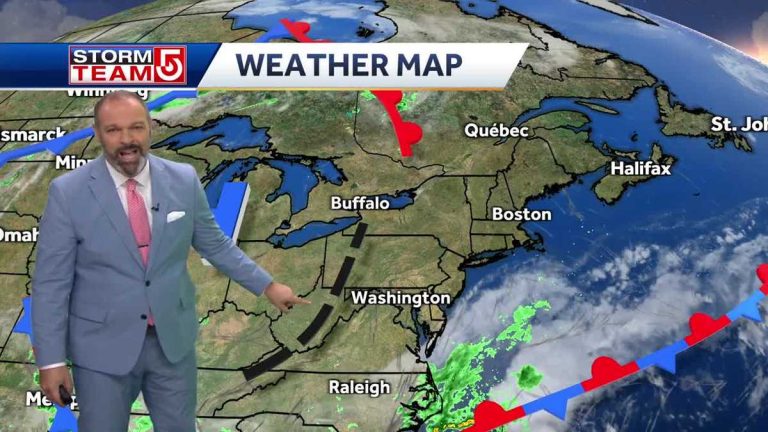
Our current sky. Yes, and the atmosphere is very high. So for people with breathing issues, it's not a factor, for example, you're not going to smell it like we did last summer. Do you remember those days when you could actually smell that pungent smell? We won't find it today. It's that mist, that color. Right now, the sky we see through the rooftop camera is a little brighter and brighter, but it's been a little hazy since Saturday morning. Switching gears, wanted to show you what's happening in Worcester and Boston right now. side by side. You step outside and you realize, yes, it's a little hazy out there. That's wildfire smoke. It won't be much thicker than it is now, but it will be there. So you might get a little extra boost as the oranges and reds become more poppy at sunset later tonight. When haze appears in the atmosphere, it comes from wildfire smoke in central Canada and across the Great Lakes. It's a small amount, but enough to make you notice it in today's haze. The further north you go, the more prevalent the smoke becomes. Some of this smoke will begin to sink southward. Will try tomorrow but in the meantime, the low pressure area extends south, watch it push it back to the north. So while you get a really deep red, we never get into a really thick fog. We'll get some deeper reds, but the really heavy smoke aloft will continue into far northern New England. Really close to the US-Canada border. OK So where we can feel it, it's now in the 50s and 60s. It's super comfortable there. We experienced low dew points yesterday and that will happen again today and tomorrow. There were already some clouds drifting towards the capes and islands before we started to notice the humidity starting to creep back up. They are fragmented. Everyone else saw quite a bit of sunshine today and I thought it was going to be another day. Just like yesterday. Sunny, low humidity, rain to the south and high pressure to the west, bringing us northwest winds. But right in the middle, if you look closely at this, you'll see what's that black dotted line that I drew here? Well, you're not seeing any cloud formations, but there's a little bit of a weakness, a disturbance in the atmosphere that's going to move away from the Atlantic coastline later today. Then it turns into a low pressure area, almost like a coastal low pressure area, very weak. It's not a super strong storm, but it will be a brief break in the nice weather we have here starting tomorrow. Later in the day. OK Today's high temperatures are well into the 80s. There's a sea breeze along the coastline, but that means the beach will be cooler. The ebb tide is coming. Well, early morning, 1037, Boston Harbor. For beachgoers, winds will begin to shift to the east today. This again means the parking lot will be cooler and may actually reach 128 degrees. Once again cross the main city of Boston Worcester and enter the Merrimack Valley. It was a very good night for us. for tomorrow. I plan to go to the Cape of the Islands at 70 hours. This is where the clouds start to form. First, when a coastal or ocean storm system starts to hit us, it will move north and west from there. Let me break it down for you in FutureCast. It's 10:00 tomorrow morning. Incidentally. Note that clouds will begin to drift away to the north and west throughout the day. It's not until late afternoon or really close to dinner time that we start to notice the rain sloping towards the headlands and islands, and starting to spread inland around 10pm tomorrow evening. So we'll have scattered showers around us from Sunday night into Monday. I imagine you need an umbrella, windshield wipers, first thing on Monday morning when you go back to work. Not rain all day, but the threat of rain all day, if that makes sense to you. Then, as we get into Tuesday, things start to take a turn for the worse. This is when the humidity really starts to creep back up. You'll notice that there is a risk of showers and thunderstorms every afternoon starting Tuesday, Wednesday, Thursday, and Friday as humidity increases. So we'll keep an eye on this until
Video Forecast: Sunny and comfortable weather before showers arrive
Sunday will bring bright skies and lower humidity, with scattered showers expected later Sunday.
Sunday will bring bright skies and lower humidity, with scattered showers expected later Sunday.

