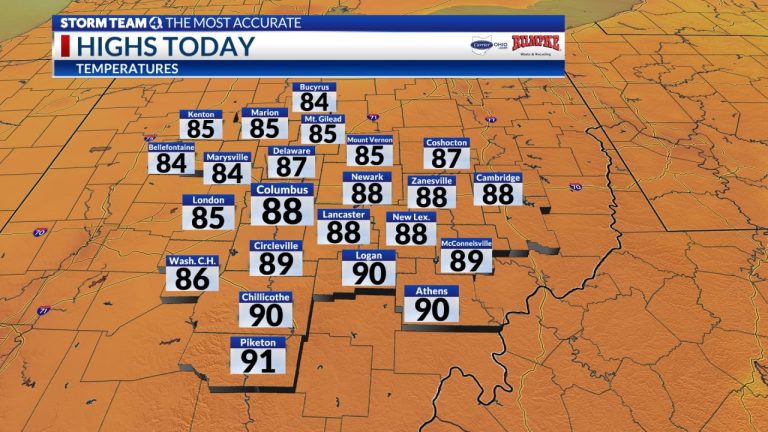
As high pressure moves eastward across the Great Lakes, creating a dry, seasonally warm northerly flow, less moist air enters Ohio.
As high pressure shifts to the Northeastern states, more significant warming will cause readings to climb back into the upper 80s and low 90s. Winds will shift to the south, allowing more moist air to flow north.
A few showers and storms are possible in southwestern Ohio Sunday night, but most of the moisture will remain in southern central Ohio into Sunday night.
Rain will fall through the first half of next week with a few rounds of showers and storms, and a stationary frontal boundary near the Ohio River will lift northward by midweek.
Temperatures will top out in the mid-80s, with morning lows throughout the week not dipping into the lower 70s amid the muggy air mass.
forecast
- Saturday: Sunny. High 88
- Sunday: Mostly sunny and warm with southerly rain. High 91 (63)
- Monday: Cloudy, sticky, scattered showers, stormy. High 85 (70)
- Tuesday: Scattered showers, storms. High 87 (71)
- Wednesday: Partly sunny with a few storms. High 90 (70)
- Thursday: Hot. Humid, stormy in the afternoon, maximum 91 (71)
- Friday: Scattered showers, storms. High 87 (72)
