We expect temperatures to continue to rise on Sunday, with a high in Des Moines around 90 degrees and a heat index reaching into the 90s.

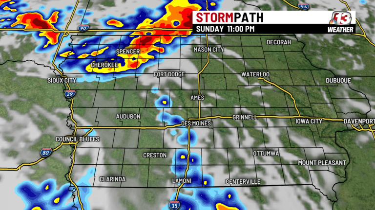
An upper-air disturbance moving north toward Iowa will trigger storms late Sunday night and will continue into early Monday morning as a wind shift line begins to move across the state. We'll also see the potential for storms later this week, Wednesday through Friday, as a series of fronts and upper-level waves move through Iowa. The gallery below shows the timing of the Storm rounds.


The short-range HRRR model below shows the potential for organized updrafts during the storm late Sunday night into early Monday morning, giving us a slight chance of seeing some severe thunderstorms during this time.

Colorado State University's algorithm (the output of which is shown below) gives us the probability of severe weather on Wednesday (Tuesday will lack the lifting mechanism to cause storms).

The European model below shows the expected range of rainfall in Iowa through Monday.

The weather remains warm this week, with highs in or near 90 degrees by Friday, as shown in the picture below.


The 6- to 10-day and 8- to 14-day weather forecasts predict above-average rain chances and below-average rain chances through around the first week of August.


Your WHO13 7-day forecast:

