Monday could have been more active if not for the showers and storms we experienced earlier in the day. This essentially pushes the threat of severe weather to our south and east, keeping conditions dry and clear overnight.

However, this is just the first of many opportunities for storms in northern Illinois this week. Especially now that the weather is going to get hotter and more humid. Tuesday will start with mist and temperatures in the mid-60s. If you plan on driving out in the morning, slow down if you do encounter any areas of low visibility.

Except for an afternoon shower or storm, it will stay dry most of the day with highs in the mid-80s. With light southwesterly winds, the heat index is expected to jump into the 90s.
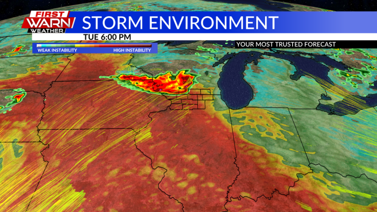
By evening our attention will turn to the Northwest as the evolution of the storm will determine who will see the highest coverage of strong to severe storms and flash flooding. Earlier today, the Storm Prediction Center listed areas from southeastern South Dakota to northern Georgia as a Level 2 slight risk for severe weather.


This does include our area near the Mississippi River, which is dominated by damaging winds. The rest of the region is under marginal risk level 1. There will also be some uncertainties on Wednesday, such as the state of the atmospheric “cap” or lid and the location of the warm front. Currently, the Storm Prediction Center places the entire region under a Level 1 marginal risk. Again, this applies to strong winds and heavy rain.


A more organized storm system will slide to our north Thursday afternoon, continuing the potential for storms and flash flooding. Headlines also include additional heat and humidity, with heat indices likely to approach 100 degrees on Wednesday and Thursday.
As mentioned before, always check the weather forecast and be sure to take the necessary steps to protect yourself and your loved ones from severe weather and heat. We do see this active and hot weather pattern easing into the weekend as an area of high pressure helps bring in cooler air.

