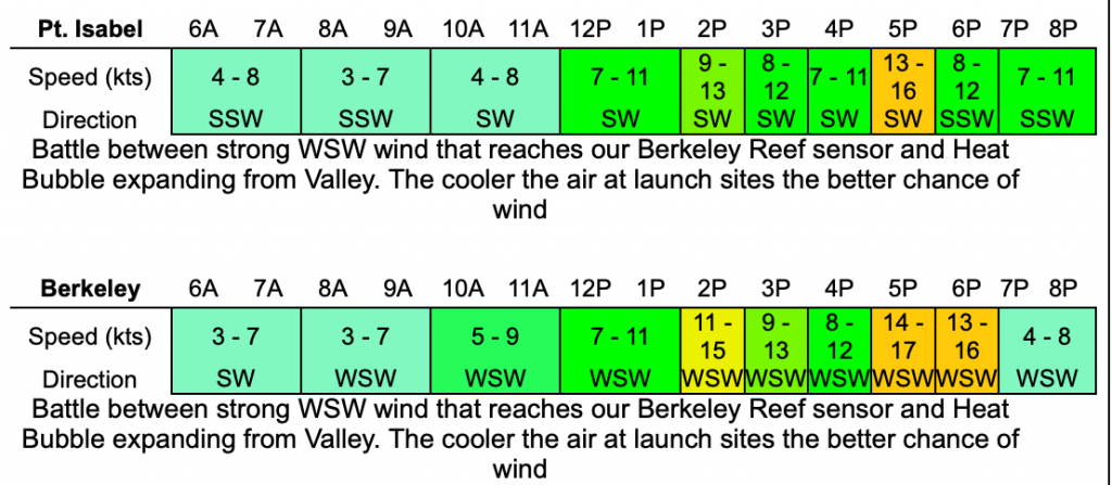
Check out the predictions for Pt. Isabel and Berkeley today.
When a heat wave occurs and there is no sea layer or the sea layer is thin and retreating rapidly, predicting East Bay winds becomes very difficult.

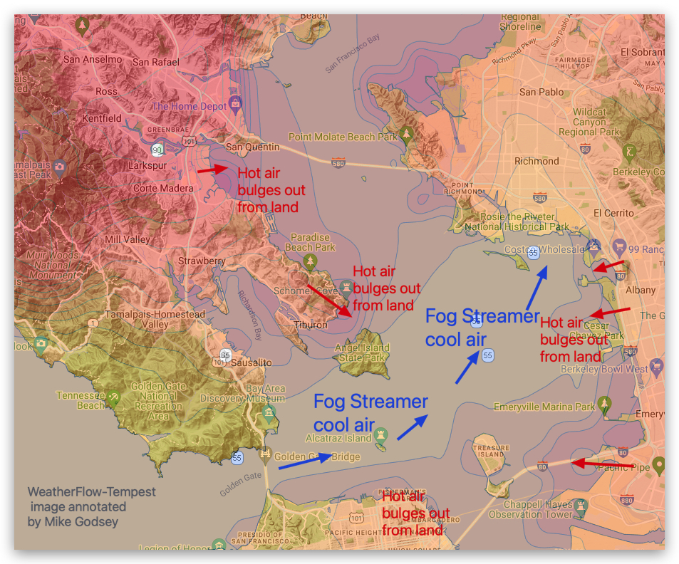
That's because hot air from the East Bay hills and Central Valley extends toward Sherman and Pullman Islands. Isabel, Racetrack, and Berkeley Launch Complex. This hot air creates “bubbles” of low-pressure air. If the low pressure is located just inland of the launch site, the cool west-southwest winds will actually accelerate.
But if the heat bubble moves over the launch site, a windless to weak wind area will form near the coast, making it difficult to reach the strong winds outside.

Unlike Pt., Sherman Island may have related issues. Isabel, Racetrack, and Sherman, Berkeley

Located in a natural fog and wind channel that extends into the Central Valley. As a result, strong winds may weaken by midday as the heat bubble moves over Sherman Island. Sherman Island winds then increase in the afternoon as cool ocean air flows through the channel.
Because it's impossible to predict exactly when a heat bubble will advance or retreat, you should use our 11:30 AM forecast to fine-tune your own forecast before a long drive. Here are some tips:
Please go to iwindsurf or ikitesurf wind map website. Zoom into a larger area around the launch site. Click the sensor for your site. In the small box that pops up, note the temperature at the launch site. Then click on inland sensors at various distances from your site. If you find that the temperatures are about the same and you see wind at your launch site, lower your windows and head toward your launch site. If the air feels cooler as you get closer to the site, you may find it's very windy.
If your data collection finds it's hot near the launch site, stay home or work until you see cooler air. Of course, you should also view animated satellite images of fog movement.
