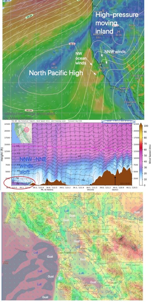
We are in the middle of a Diablo wind event, with northerly winds gusting up to 50 mph at higher elevations and Mount St. Helena gusting up to 75 mph. Subject to red flag fire conditions.

Today’s surface wind:
Unfavorable strong NNW/NNE winds aloft and moderate WNW sea breezes try to bend into the bay, forming extremely sporadic up and down winds. This happened…
1. A portion of the North Pacific High moves inland into far northern California and eastern Oregon.
2. This creates adverse NNE winds from the surface to 10,000 feet in the morning.
3. These winds die down towards the afternoon, but still struggle with northwest sea breezes in the afternoon. 4. The strongest winds occur from Ocean Beach to Waddell.
4. In the bay, northerly winds will hit the Marin Coast Mountains and may skip over the Creasey to Treasure Island area.
5. There were brief strong northwest to northwest winds at Alameda, Coyote, and Launch Site 3 in the late afternoon, but the winds quickly died down.
Overall, we are seeing gusty and calm winds moving across the bay from the north.
