not many people know
Paul Homewood
h/t Ian Magness
We will all drown!

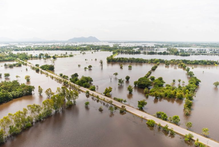
The Environment Agency has released new figures today (Tuesday 17 December) showing that 6.3 million properties across England are in areas facing one or more flooding threats from rivers, seas and surface water.
Using the best available data from the Environment Agency and local authorities, new National Flood Risk Assessment (NaFRA)provides a single update on current and future river, marine and surface water flood risks in England. NaFRA was last updated in 2018.
In addition, the Environment Agency has also updated the National Coastal Erosion Risk Map (NCERM) for the first time since 2017. National Regional Coastal Monitoring Program Network.
The Environment Agency used cutting-edge methods to create new bespoke software that integrates detailed local flood risk models – both the Agency's own and those of local authorities – into national profiles. For the first time, NaFRA and NCERM have considered the latest UK climate forecasts from the Met Office.
These updated assessments provide a clearer understanding of flood risk across the country, and the data will be used by government, the Environment Agency and local communities to plan and improve flood resilience in areas at risk.
Figures show that a total of 6.3 million properties in England are in areas exposed to one or more flooding threats from rivers, seas and surface water.
About 4.6 million of those properties are in areas at risk from surface water flooding, where too much rain overwhelms drainage systems, causing surface water runoff, also known as flash flooding. This is a 43% increase from the Environment Agency's previous assessment. These changes are almost entirely due to significant improvements in the Environment Agency's use of data, modeling and technology to more accurately assess surface water flood risks.
About 2.4 million properties are located in areas at risk from river and sea flooding. While the total number of properties at risk has not increased, the number of properties in the highest risk category has increased by 88 per cent, with an area more than a third more likely to flood in any given year. There are a number of reasons for this change in risk, most notably improvements in data and modeling methods used to assess the likely frequency of flooding.
As climate changes, the total number of properties in areas facing threats from rivers, oceans or surface water could rise to about 8 million, or about a quarter of all properties, by mid-century.
https://www.gov.uk/government/news/environment-agency-publishes-major-update-to-national-flood-and-coastal-erosion-risk-assessment
.
Naturally, the media has gone into full alarmist mode. Sky News, for example, tried to link all of this to climate change, with lines such as “It rained suddenly, the waves surged, and the river banks burst.”.
In fact, as EA makes clear, much of the increase in risk is simply due to “improvements in data and modeling.”
Regardless, the EA's estimate of 6.3 million properties (one in five) at risk is completely ridiculous.
Their own database shows that only around 5,000 houses were flooded in March 2024, a fairly average year for flooding. Even in 2007, the worst year since they started keeping records, the number was only 55,000.

To put these numbers into perspective, the worst flooding so far this winter came from Storm Burt, which flooded 1,375 homes:

https://www.gov.uk/government/news/the-latest-updates-on-storm-by
Their previous assessment put this number at risk: 5.8 million:

https://www.gov.uk/government/publications/flood-and-coastal-risk-management-national-report/flood-and-coastal-erosion-risk-management-report-1-april-2023-to- March 31, 2024
But most of them are low or very low risk.
Interestingly, they have a website where you can check out your own area:

https://check-long-term-flood-risk.service.gov.uk/postcode
Our house is classed as 'low risk' and although we live on a hillside we have never experienced any minor risk of flooding, even during the 2007 Sheffield floods.
We live in a town with a population of over 20,000, and the only homes I've seen affected by surface water flooding are a few at the bottom of the valley. These incidents are always caused by clogged gutters and are nothing more than an inconvenience, with an inch or two of water lapping at the front door.
I suspect our entire town is classified as “low risk” as there are over a dozen homes at risk. This is because EA works with “regions” rather than “personal properties”.
In short, the 6.3 million properties said to be at risk may be more than 60,000 properties.
Relevant
Learn more from Watts Up With That?
Subscribe to have the latest posts delivered to your email.
