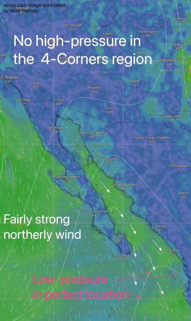
Part 1 of this blog covered the basics of how low pressure south to southeast of Cabo San Lucas at the tip of Baja affects the Sea of Cortez winter monsoon.
In this blog, this diagram shows how low pressure can produce wind even when large wind turbines, NPH, and 4-corner high pressure are not present.
The second blog is more technical and discusses the causes of low pressure troughs.
The low pressure area south of Cabo in winter is affected by a variety of atmospheric and oceanic factors:
1. terrain effects
The surrounding mountainous areas (the Sierra Madre Occidental to the east and the main mountains of the Baja Peninsula to the west) direct the northerly winds from the Sea of Cortez. Near Cabo, the wind leaves the confines of the mountains. This causes the wind to fan out or diverge. This promotes the development of a low-pressure trough that increases the size of the Sea of Cortez and accelerates winds. You can see this low pressure through the white isobars in this image.
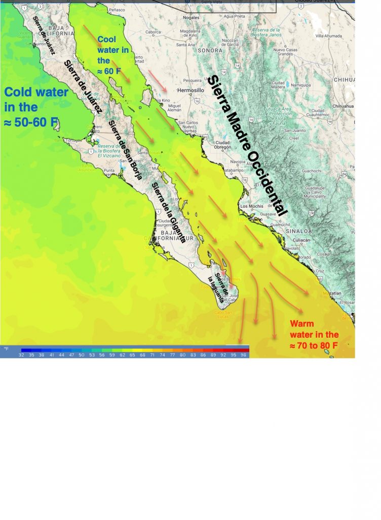
2. Land/ocean temperature comparison
During the long winter nights in the southern Sea of Cortez, especially in the Eastern Cape of Baja California, there is a significant temperature gradient between the warm waters of the Sea of Cortez and the cooler landmass of the Baja California Peninsula and mainland Mexico. This gradient can cause local atmospheric instability and favor the formation of low-pressure troughs.
3. rapids and upper trough Place
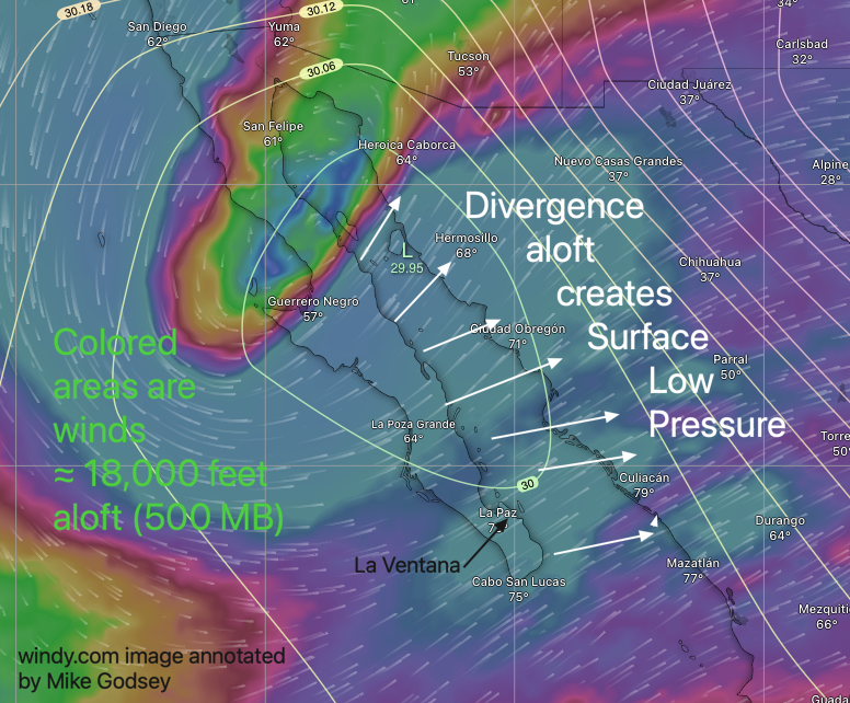
During the winter, the subtropical jet sometimes dips southward near or over northern Baja. This makes the upper trough above Baja, northern Mexico, about 18,000 feet (500 MB) high.
These troughs can enhance divergence aloft, where winds spread, thereby promoting the formation or strengthening of surface low-pressure systems. This divergence could cause the low south of Cabo to migrate south of Baja or even across the Sea of Cortez within days, weakening the surface pressure gradient and disrupting winds.
3. El Niño-La Niña Southern Oscillation (ENSO) Impact

During certain ENSO phases (particularly El Niño), the subtropical jet becomes more active and moves further south.
This could bring prolonged periods of weak wind clouds (or even light rain) to southern Baja and cause low pressure to remain over the eastern Cape of Baja, resulting in a prolonged wind drought.
During La Niña years, the average position of the subtropical jet stream shifts northward, so cloudy skies less Common, low pressure is more likely to stay south of Cabo, strengthening northerly winds.
4. Moisture convergence
As the water evaporates, the relatively warm Sea of Cortez acts as a source of moisture. When prevailing northerly winds blow moist air over warmer seas south of Cabo San Lucas, the air rises, cools and condenses, further reducing pressure in the area.
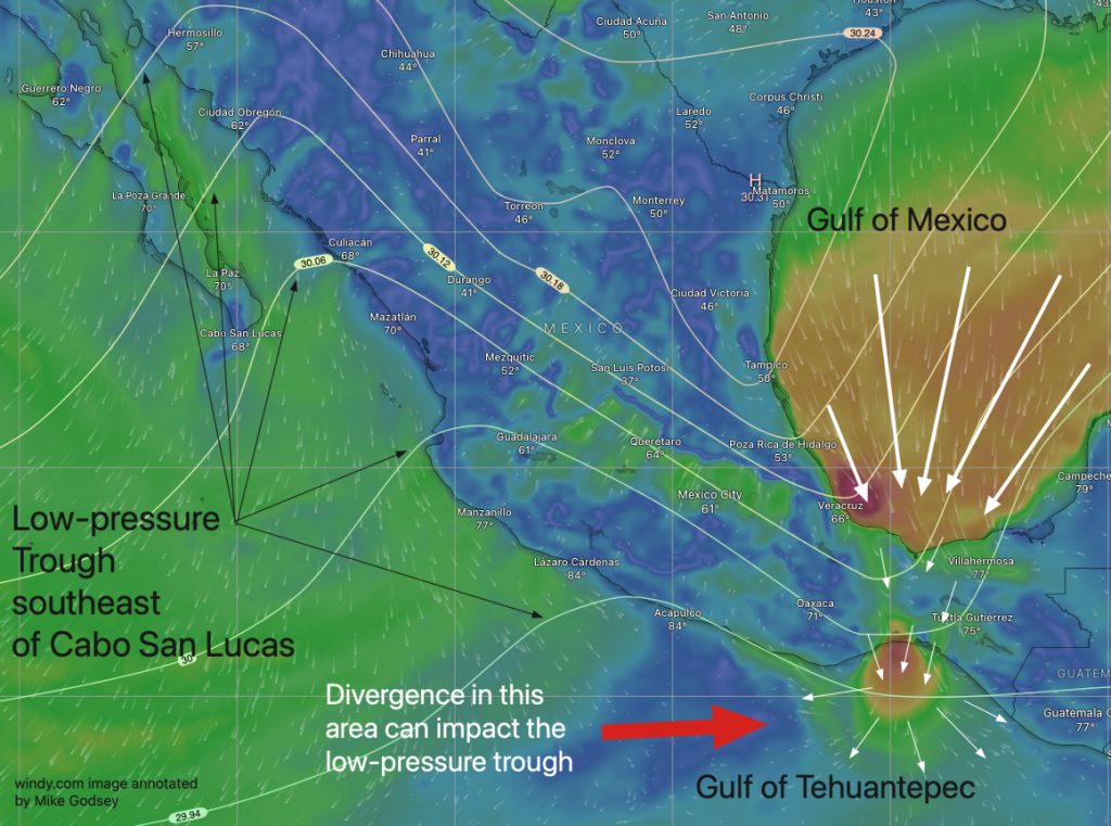
5. Tehuantepec Wind disagreement
Whenever there is high pressure, northeasterly winds develop in the Gulf of Mexico from Texas to Florida. The land between Texas and the Yucatan Peninsula creates a natural wind funnel, generating extremely powerful winds through mountain passes leading to the Gulf of Mexico.
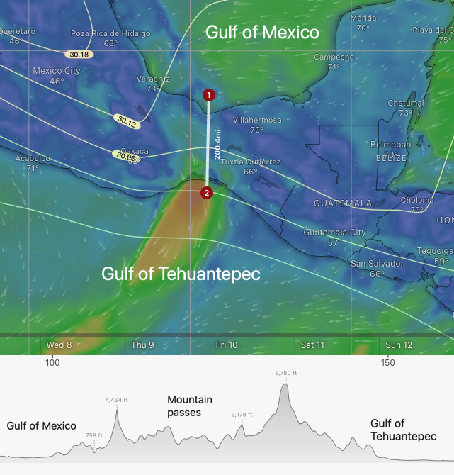
Tehuantepec on the Pacific Ocean. Fishermen and yachtsmen alike fear these winds. When hot, moist air from the Gulf of Mexico has to climb over the mountains, it cools and produces heavy rainfall. Cool, dry winds then blow down the pass and into the water. There, the winds diverge and interact with warm tropical air, which strengthens Cabo's southeastern low and affects its position.
6. Forecast impact:
As you can see, there are many factors that influence the size and location of low voltages. Additionally, none of the higher-resolution models covers the low-pressure region, making it difficult to pinpoint its location. This leads to poor predictions.
