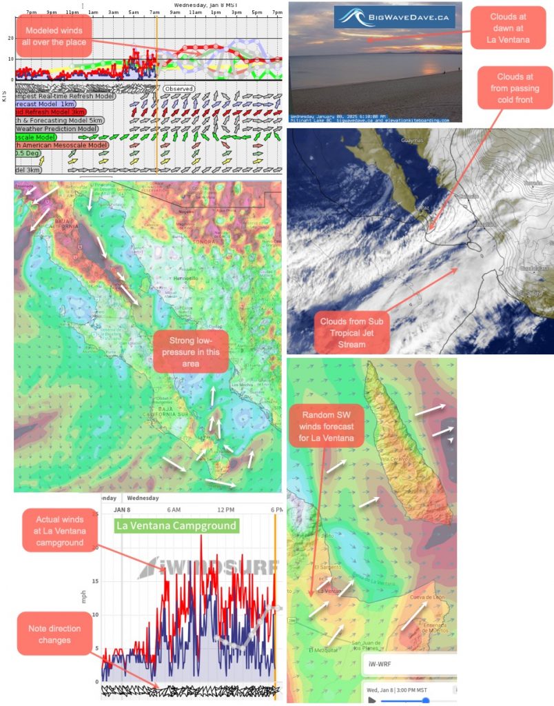
notes: This autopsy image covers the impact of Sea of Cortez low pressure on the East Cape Baja winds. Tragically, this same low pressure created massive Santa Ana winds in Southern California, creating nightmare fire conditions. This event will be covered in an upcoming blog post.
This is the text portion of my wind forecast yesterday for January 9, 2025
Today’s trendy recipe: Today’s recipe has more Basura-inspired ingredients.
1. 60 knot SSW wind blowing over us from near cutoff low at about 18,000 feet.
2. This creates a surface low near the central Sea of Cortez, which generates strong northerly winds from San Felipe to Muleg, and strong sporadic adverse westerly winds near the La Ventana launch site.
3. Since this kind of wind blows offshore and must go over mountains and ridges, it usually does not reach the shore except randomly appearing at the mouth of the river.

4. At the same time, a cold front moved through, bringing cooler temperatures and cloud cover, mostly to the south of us.
5. Lurking to our south is the terrifying subtropical jet stream, but it's not adding to today's recipe for disaster.
notes: Likewise, use caution when fishing and kayaking near the arroyos in the morning's clear waters, as strong westerly winds are possible at random.
Window area: Up and down W-WSW winds sometimes reappear
