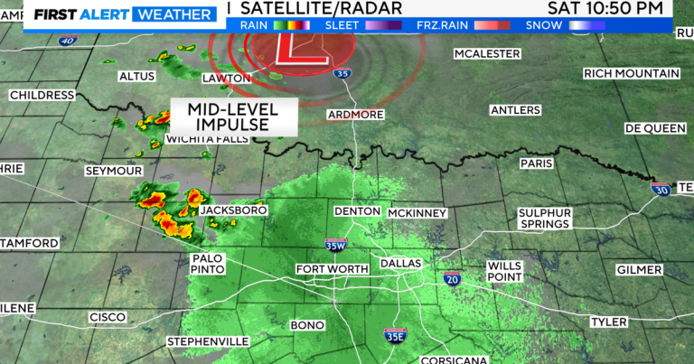
North Texas – First, there’s rain on the radar!
Some thunderstorms are trying to expand to our northwest as they move quickly across Oklahoma. This could bring some showers and thunderstorms to the metropolitan area to start our Sunday. I don’t mind waking up to thunder!
Isn't this the best?
Here's a higher-resolution model showing some surge in activity and perhaps some thunder ahead of this rush tomorrow.
The Dallas-Fort Worth area is also likely to see a few storms Sunday afternoon and evening, some with gusty winds, but I'm not concerned about a widespread severe threat. At best, some very localized flooding is possible, but only if the storm persists for a while, perhaps later tomorrow night, along the I-20 corridor. The timing will also depend on the small border crossing from Oklahoma.
Finally, some models are trying to keep activity in the area Sunday night, but it appears to be very isolated. I doubt much of the activity continues long after sunset.
Next week, towards the end of the week, the chance of rain seems to be greater, but we'll see where the trend goes on Thursday.
Upper-level high pressure remains to our west, allowing the jet stream to continue bringing us rain chances and slightly cooler air.
Rainfall forecasts will vary, but broad consensus still shows the highest rainfall trends to the south and east, with clear differences north and south along the I-20 corridor.
Seven days in July are looking pretty good.
have a good weekend!
